
Buckton Fields lies on the northern edge of Northampton adjacent to the White Hills residential area, between A508 Harborough Road and A5199 Welford Road.
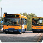
The site at Buckton Fields is particularly well linked to existing transport routes and facilities:| • | Several bus routes pass close to the site along Harborough Road and Welford Road; |
| • | Bus stops close to the site on both radial routes; and the |
| • | Sustrans national cycle network runs to the west of the site along the disused railway. |
In delivering the proposed development for the Buckton Fields site, Ensign acknowledges that there is a need to improve existing roads and contribute to the public transport network. Ensign has therefore put forward a comprehensive and balanced range of proposals to support Buckton Fields and minimise the impact of traffic generated by development on the existing transport system.
The sustainable transport and movement strategy for Buckton Fields intends to include the following:
| • | Improved bus routes and new services from Buckton Fields to Northampton Town Centre via Kingsthorpe and to Moulton Park via the University Campus; |
| • | A new park & ride facility with up to 500 parking spaces and frequent town centre connections to supplement the local bus service for new and existing residents as well as users of the proposed employment area; and |
| • | Highway improvements relating to the A508 corridor |
A network of footpaths and cycleways will provide residential areas with safe, direct access connecting them to key areas such as the local centre, primary school and open spaces reducing the need for journeys by car. Footpaths and cycle routes will also connect Buckton Fields with the established National Cycle Network of Brampton Valley Way.

;)
;)
Please click on individual plans to enlarge